Below are pics of this trip along with some commentary. I had no internet or phone in this wilderness area so no blog updates. It is all in this single blog. The total trip distance was just under 250 nm. See link below to view route in Google Earth:
Very little wind, mostly motoring or motor sailing. Overall warm temps and much swimming in the protected harbors, though water temperature was usually between 65-68 degrees F. So swims were short!
Except for Thompson Island and CPR Slip which are designed for having multiple boats, all other anchorages I was the only boat, which was very pleasant. This was a primary reason I stayed on Lake Superior this year. Enjoy the pics with commentary below:
 |
| NW Ontario Coast Cruise - 2013 |
 |
| All though the first stop was near the border in the Susie Islands, Thompson was the first key stop. The Thunder Bay boaters have built up this site on government land to make it very enjoyable for all that visit. |
 |
| Google Earth view of the harbor area. Their are trails that go around parts of the island with great overlooks, which you will see. |
 |
| The Canadians do not sail from marina to marina to get a shower, they go from sauna to sauna built in the bush on government land and accessible to all. They only ask that you replenish the wood and the water and keep facilities clean. |
 |
| A very expansive dock system built all by volunteer boaters that use the area. They do solicit funds for supporting the facility. They have had up to 23 boats in here at one time, obviously rafted together. |
 |
| Picnic tables, built in seats on the dock, a covered eating area with candle chandelier, nothing but the best. Besides the sauna, there are several outdoor biffies, lots of trails, and a place to play horseshoes. |
 |
| Here is a shot from the harbor overlook from one of the trails that uses a series of ropes and even built in steps to climb to the top. |
 |
| Looking NW toward Pie Island, again from one of the trail overlooks on the north side of the island. |
 |
| If you look close you can see a mast sticking up from the harbor just right of center. |
 |
| Looking east toward Isle Royale on the U.S. side of the channel about 16 miles away. |
 |
| The trail |
 |
| Clear water and also cold, Isle Royale in the distance. |
 |
| Looking SW on the SE side of Thompson Island |
 |
| Wonderful Water! |
 |
| Another shot along the SE side of the island |
 |
| The trail follows the beach back to the harbor at this point, I just climbed down that cliff |
 |
| The horseshoe setup |
 |
| Leaving Thompson heading up past Pie Island to the Cape. |
 |
| Approaching the entrance to Thunder Bay, Thunder Cape in the background. |
 |
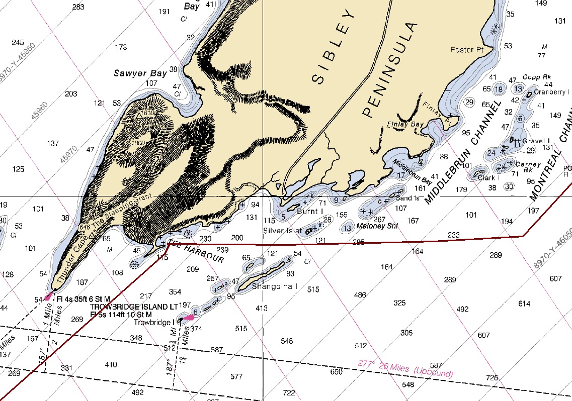
| Thunder Cape & the foot of the Sleeping Giant |
 |
| Trowbridge Lighthouse |
 |
| The Sleeping Giant in repose, head to the right, feet to the left. Thunder Cape makes up the feet. It is also called the Sibley Peninsula and is a Provincial Park. |
 |
| Sun sparkling off the morning water working my way NE in the channels |
 |
| Low lying hazards all along the way! |
 |
| The next photos are of Root Bay, one of several anchorages in the area. |
 |
| Google Earth shot of Root Bay and Loon Harbor. I stayed in Root Bay going up and Loon coming back. The red boxes are the satellite tracking hits as I moved along. |
 |
| Some flowers along the way as I kayaked around the bay one evening. |
 |
| Perfectly calm and quiet anchorage, not another boat in sight! |
 |
| Early morning motoring up the channels between islands, again calm. |
 |
| Just a mist of fog in the early calm morning |
 |
| Approaching Lamb Island Lighthouse |
 |
| CPR Slip is similar to Thompson Island except it was originally owned by the CPR Railroad, it got handed down to a family who allows the Red Rock and Nipigon boaters to maintain and use the place. They have replaced old buildings with new, built up the docks, hauled out garbage and made it a very nice place to visit. As at Thompson, there are numerous trails to hike. |
 |
| The CPR old hands call this area the "Mine Field" because of the numerous rocks and reefs which you can see in this Google Earth overhead. Boats frequently go aground by carelessly approaching the harbor which has an unmarked entrance. |
 |
| Close up of CPR Slip. The harbor was actually man made by removing gravel for railroad beds which left a nice harbor. Numerous boats can stay overnight at one time. |
 |
| Fish tug conversions are commonly used in this area due to their inherent seaworthiness for Lake Superior. There were three in the harbor while I was there. |
 |
| This one left soon after I arrived. Nice folks out of Nipigon. |
 |
| They all look just a little different, here is another that came in soon after I arrived. They were out of Red Rock |
 |
| The trail through the spruce fir forest heavy with moss. |
 |
| I have no idea what it is but it looked interesting! |
 |
| More interesting plant life along the trail |
 |
| A closer shot of the beautiful plants. |
 |
| Ferns on the steep slope |
 |
| I tried to get a shot of the harbor from the overlook but it was not to be, the fog stayed in for another couple hours. |
 |
| I waited and waited and waited! |
 |
| Finally decided it was not going away so I continued my hike. |
 |
| Looking north along the east side of St. Ignace Island with fog rolling through. |
 |
| More Fog! |
 |
| I cheated, I took this picture of the harbor from the overlook in 2008 when my son Paul and daughter Kelly were with me. Fog was a problem then too! |
 |
| The elaborate rope system to help get up and down some of the steeper portions of the trail. Some places were extremely steep! |
 |
| More plants |
 |
| An extremely intricate spider web intended to trap a critter to eat! I saw the spider working and he was really, really small! I can't imagine how long it took to make this? |
 |
| I followed an additional trail that circled this small inland pond. There was lots of moose sign in the area. |
 |
| Wood for the sauna, the rule is written! |
 |
| This cabin supplemented as an additional sleeping area for boats with extra bodies. It also had a nice screened area for getting out of the bugs, if there are any. We were pretty much bug free. In the foreground is the fire pit for cooking and enjoying the evening fire, which we all did. |
 |
| Dash on the sauna dock |
 |
| On the return I went outside of the islands and saw this cove with drift wood washed well up on shore from the open lake storms. |
 |
| The wave line is pretty high in this area because it is open to a long fetch of northern Lake Superior. |
 |
| Thunder Cape and Tee Harbor on the way back. I had planned to go in to Thunder Bay for two days but wind and waves made that not as easy as using the NW wind to head SW toward Grand Marais so the plan was changed. |
 |
| An overhead from Google Earth. You can see why it is called Tee Harbor! Again, the red squares are the satellite hits from my SPOT tracking device. |
 |
| Evening fog after a storm passed through. You can see one of three mooring balls the Thunder Bay boaters have put in for anyone to use, first come first serve. |
 |
| The landing and trail head to hike up on top of the cliff. I didn't do it this trip since it is extremely taxing. |
 |
| The trail goes up to the top of that cliff, part of the Sleeping Giant. |
 |
| A cliff on the NE end of Pie Island on my return leg |
 |
| Leaving Thunder Cape and Pie Island behind and heading to the U.S border and the Susie Islands for my last anchorage of the trip. Just previous to this picture I had my spinnaker up and a 20 knot gust of wind ripped out my tack attachment. I was scrambling around for some minutes trying to get it under control and back aboard without damage to the sail or loosing it overboard. That I did successfully but ended up with damage to the aft starboard stanchion that got bent over about 45 degrees by the furling line that held the foot of the sail after the tack fitting failed. A little excitement to end the trip with! |