Friday, September 7, 2012

Munising to Marquette


Departed Munising at 0615, well before sunrise, to try and beat a frontal passage due to go through Marquette about 1400-1500.  There was a breeze blowing from the SW pushing me against the dock so I was afraid that I would have trouble getting away by myself and there was no one around to help.  However, I got a lull in the wind and pushed off and backed out without a problem.

It was cloudy and fog was threatening to the south.  I motored out passing Grand Island to starboard and then up to the main lake with a light breeze from the SW.  Once I passed Au Train Point the wind picked up and I was making good speed with Main and Genny.  I kept the engines at slow idle to keep my speed up since I was on a time line to beat the front.

Munising to Marquette - 09/05 - 34.2 NM
 Heavy T-Storms, Wind, & Waves Last 15 NM

Once I passed Laughing Fish Point on a straight course for Marquette at 15 NM I observed on Sirius Weather a large Thunderstorm headed my way.  It would not be a direct hit but would give me a glancing blow.  I wasn't too worried since I figured after it passed the winds and seas would quiet down.  However, that was not to be!

The storm hit with heavy rain and winds to 31 knots.  The wind stayed steady afterwards at 18-20 knots right on the bow.  The seas built and Dash was slamming into the troughs, jarring the whole boat.  It would almost come to a stop and then the backwash of a wave would flow over the engine cowlings so I was afraid the engines would drown out. 

I had the main up helping the engines and could have fallen off for better speed and less slamming but I was afraid I would lose too much ground and just pay for it later trying to come upwind from someplace south of Marquette, so I held course. 

Finally rounded the light at the Marquette harbor entrance and worked my way up to the marina.  I was worn out, the rain was coming down hard, and the wind was still brisk in the harbor so I chose to anchor in a mooring field near by and get some rest and something to eat. 

The front finally passed about 1600 but it was a non-event.  The skies cleared up, the sun came out, and the wind went calm!  Not what you expect with a cold frontal passage in this neck of the woods!  So I called the marina and went in and docked, got a shower, and went to "Latitudes" for a nice dinner in the outside seating overlooking the sparkling harbor in the late afternoon sunlight.  Very beautiful and an extreme contrast from the tempest to the peacefulness of the harbor, in just a few hours time!

Sorry no pictures of the storm, I was too busy trying to keep the boat moving and stuff from being broken with the jarring impact of the waves.  However, I have some nice pics of Marquette in the afterglow.  Marquette is one of the nicest towns on Lake Superior.  Northern Michigan University is located here and most of the old downtown is still very active with many beautiful old buildings.  Enjoy!

Dash Resting In Cinder Pond Marina After The Storm
The Historic Iron Ore Ship Loading Dock
The Isle Royale Queen III
Now In Service As A Marquette Tour Boat
The Isle Royale Queen III Saw Many Years Of Service Taking Passengers Out To Isle Royale
Condos Located On Harbor Green
Would Like To Buy But Mostly $300,000 And Up.
Townhomes Also On Harbour Green But Worse
Mostly $450,000 And Up!
And This Is The Boonies!!
Walkway And Bike Path Along Harbor Wall
Downtown Area Is Very Close To Marina
Bell Tower
History Of The Bell
"Donkers" Was An Excellent Breakfast Place
On Left Is "Latitudes" My Dinner Hangout Overlooking Harbor
Main Highway/Street Heading South Out Of Town
An Attractive Church Front
University Students Sail Training
Obviously A Boating Community
Schooner Does Evening Cruises

Aerial Harbor View - Marina Upper Left
Practice, Practice, Practice!
The View From "Latitudes" Restaurant
Sold Out Beer Fest - Tickets $35
I Couldn't Get In, But Price Was High Even If There Was Music!
Green Is Full - Mostly Porta Potti's For The Fest
I Wonder Why?

Thursday, September 6, 2012

Grand Marais, MI to Munising, MI

The leg from Grand Marais, MI to Munising, MI was fog, fog, and more fog.  I left in the dark with all lights, radar, and AIS running to avoid going bump in the night!  Visibility was around a half mile, sometimes better, sometimes worse.

A fisheries research vessel was parked alongside the entrance breakwall as I departed.  As I passed I saw lights on and one guy walking the deck and it looked like they would move soon.  At least he saw me leave and the direction I took! 

I noticed later on AIS that he went east toward the Soo.  A cargo ship was also on AIS further offshore and downbound to the Soo as well.  No conflicts in my direction...so far!

About two hours out a power boat that had stayed at the town dock the previous night approached from the stern and according to the radar tracking (MARPA) he was only gaining on me at about 3.5 knots.  Pretty slow for a sleek power boat.  Later in Munising I found out he was only running on one engine.  He soon passed me and I noticed I could only keep him on the radar to about 3-4 NM.  I am finding the useful range to this radar is pretty short, even with large ships. 

I rounded Au Sable Light in fog and could barely pick it up at less than 1/2 NM.  I never saw the Grand Sable sand dunes at all.  However, as I approached the Pictured Rock National Lakeshore the fog began to lift enough I could see the water fall coming over the high cliff east of Grand Portal Point.  Unfortunately, it was too far for a good picture. The fog made the steep cliffs look more like I was somewhere along the Ireland or English coast.  It began to clear as I got further west and the sun started to have its effect.  It cleared up by the time I got to Munising.    

Grand Marais to Munising - 09/04 - 35.2 NM


Au Sable Light - About One Half Mile - If You Look Closely

Fog Always Brings Travelers Looking For Rest 
Looks Like A Finch


A Bat Landed On The Genoa Trying In Vain To Find A Place To Sleep For The Day...Unfortunately, His Persistence Led To His Demise When In Attempting To Scare Him Away I Batted The Bat With The Boat Hook!  He Went In The Drink And The Last I Saw He Was 'Dead In The Water' So To Speak!

Pictured Rocks National Lakeshore In The Fog

Lots Of Interesting Rock Formations

This Arch Was Huge - The Trees Give Perspective

Unfortunately, The Fog Obscured Some Of The Beauty

Tour Boat Out Of Munising

First Signs Of Fall Colors

Still Overcast - A Sunny Day Would Bring Out More Color

Close Up Of Stony Beach At Base Of Cliff

The High Cliffs Run For Many Miles

Water Depths Allow Passage Close Under

Suddenly Along Comes This Long Stretch Of Sandy Beach!


This Is Called Miners Castle

Oldest Wooden Light House - South Grand Island
Built 1867-Abandonded 1913

Munising & Grand Island Area

Munising, MI - Bayshore Marina


Monday, September 3, 2012

Soo to Grand Marais, MI


Departed the George Kemp Marina about 0830 to arrive at the Canadian Lock at 0900 when they opened.  I was 10 minutes early even dragging my feet.  I called the lock, no answer.  I called and called...finally at 0925 they answered.  Couple kids running the lock and I suspect they had a late night last night!  They made excuses that were quite weak. 

The good part was that I was in the lock alone, in calm conditions, and it was simple to lock through.  It was close to 1000 before I was out the upper gate.  

 Soo Locks - Canadian Lock North Side

Ship traffic was busy on the River.  Met two ships and two passed, including one tug.  See pics.  Winds on Whitefish Bay were much higher than predicted and on the bow so it was a rough slog to the Point. 


Approaching Lower Gate Of Canadian Lock - Sault Ste Marie

Departing The Lock

International Bridge

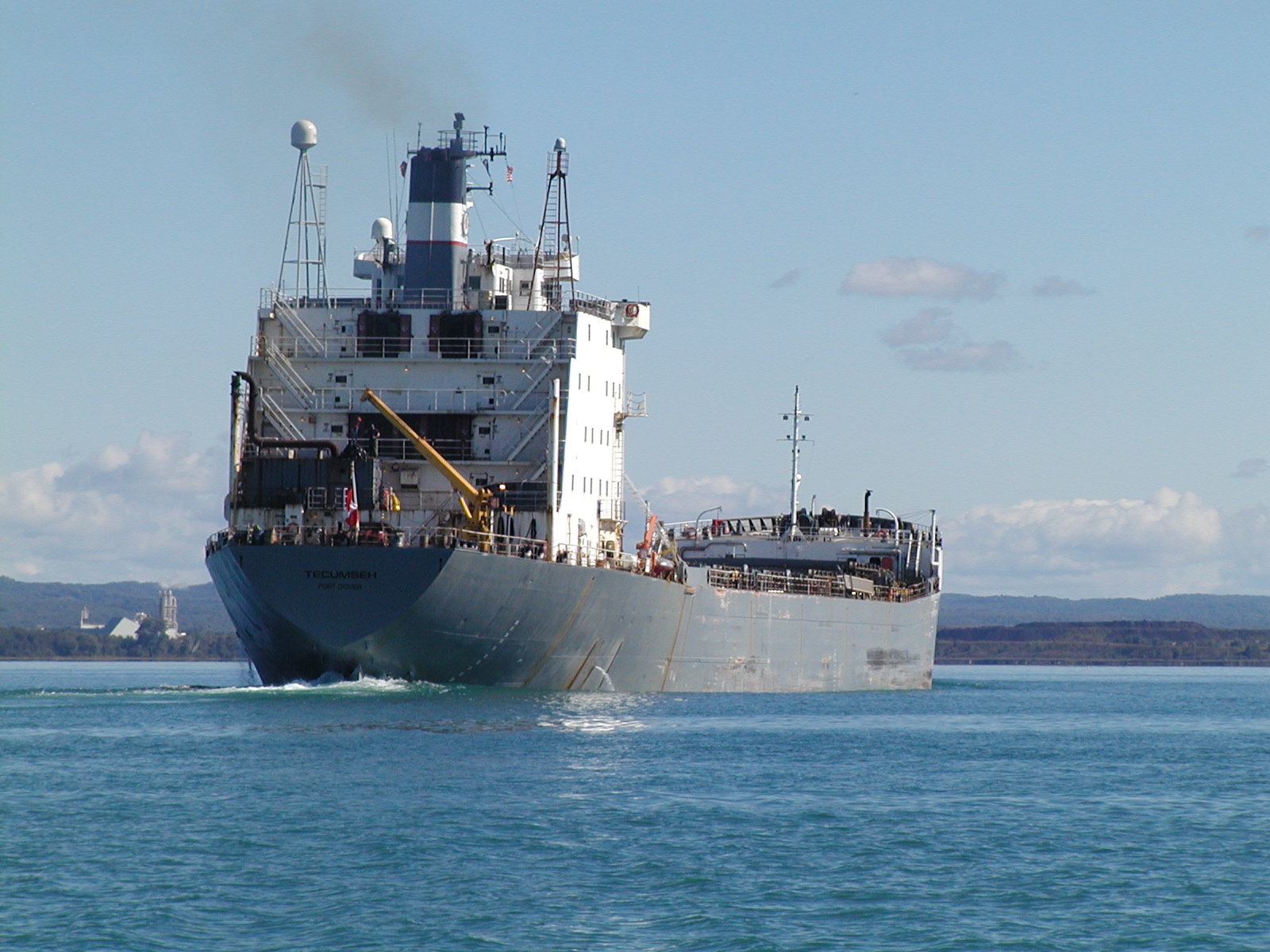
Two Ships Meeting In The St Mary's River


I'm Just Outside Channel To Avoid Both Ships


Escape Capsule On Stern


Bow Wave Of Tecumseh

Another Ship Downbound

From The Stern

Pointe Aux Pins Front Range - St. Mary's River

Tug Pushing Barge Upbound

 Soo Locks to White Fish Point Anchorage - 09/01 - 35.9 NM
I anchored out along the shore north of the Harbor of Refuge to give it a try instead of going into the tight anchorage of the harbor.  Winds were forecast light they would veer to the east, but not until morning.  I planned at 0400 wake up so figured I would just leave early if it got uncomfortable.  Bottom was sand, so good holding. 


Whitefish Point Light From Anchorage
Sand Spit At Whitefish Point - Ontario Shore In Background

Sun Finally Coming Up Over Ontario Coastline On Way to Grand Marais, MI

Anchor was up about 0545, long before sunrise around 0700.  Rounded the Point and two commercial fishing boats passed by in the dark, coming from the Harbor of Refuge and headed off to the NNW.  


Whitefish Pt. to Grand Marais, MI - 09/02 - 45.3 NM


Crisp Light - A Lonely Spot SW Of Whitefish Point
Sunset - Anchorage Grand Marais, MI
Sunrise - Anchorage Grand Marais, MI
Red Sky In Morning...Sailor's Warning!

Passage to Grand Marais was smooth and I got a good boost from the wind though I kept the speed above 5 knots with power assisting, since the leg is 44 NM. 

Arrived in the harbor and anchored by 1430, so I made good time.  Grand Marais was buzzing with people since there was some type of celebration going on for Labor Day weekend.  Had dinner ashore but debated whether I wanted to even attempt it with all the people.  It was okay but I would have preferred eating aboard Dash. 

Wind came up last night blowing 10 kts with gusts to 20 kts.  Had a leisurely breakfast and fueled up the engines.  Will buy 10 more gallons to ensure I have enough to finish the trip.  About 185 NM until I reach Ontonagon, MI, my winter port.